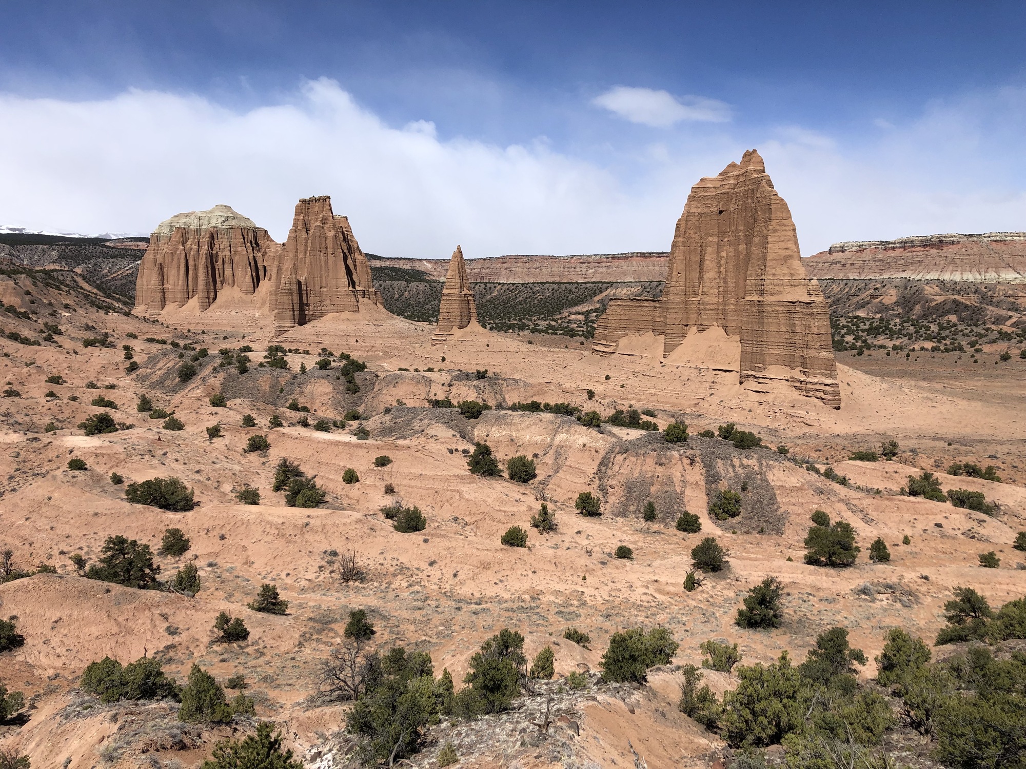
Capitol Reef National Park
A 100-mile wrinkle in the earth's crust where towering red cliffs meet pioneer orchards, and you can pick a peach in the only national park that lets you.
Our Take
Of all Utah's national parks, Capitol Reef was the hardest for us to describe after we left. Zion has its towering canyon walls, Bryce has its hoodoos and geology, Canyonlands has vast overlooks and wide-open spaces, and Arches has arches. Capitol Reef somehow has pieces of all of them, mixed with layers of human history and a landscape that just feels older. Sandstone walls rise straight out of dry washes, and the Waterpocket Fold runs for nearly 100 miles through the desert, as if someone picked up enormous slabs of the earth and set them back down sideways. Scattered through it all are fossilized oyster beds, Fremont petroglyphs, pioneer orchards, and dirt roads disappearing into the desert. It feels a little Old West, a little Jurassic Park, and somehow a little more remote than the other Utah parks we visited. The word we kept coming back to was prehistoric.
Capitol Reef was also where we finally slowed down on our Mighty 5 road trip, and that turned out to be exactly the right way to experience it. We hiked to Hickman Bridge, climbed across the slickrock to Cassidy Arch, drove the Scenic Drive, and watched the last light hit the Henry Mountains. We meant to take a short walk in Capitol Gorge and ended up following it all the way to the Pioneer Register, where settlers and other early travelers scratched their names into the canyon wall. Grand Wash felt like someone had crossed Park Avenue in Arches with a dry version of Zion's Narrows, with enormous sandstone walls rising on either side of you.
Some of our favorite memories came from driving farther out, though. We spent a day looping around the Waterpocket Fold, climbing the Burr Trail Switchbacks through a landscape that seemed to get emptier and stranger the farther we went. (Before we left, Dustin texted his parents instructions to call the Garfield County Sheriff if they didn't hear from us by a set time. Overly cautious, maybe, but it's a dirt road into the middle of nowhere with a kid in the back seat.) And then there's Fruita, with green orchards, old barns, and the Gifford Homestead, where we arrived too late for the cinnamon rolls and Allison and Warren settled for ice cream while I ate two small pies: cherry and strawberry rhubarb.
Capitol Reef still has a little bit of that pre-Instagram National Park feeling: get out of the car, follow a wash between the canyon walls, drive a dirt road farther than you planned, and see what you find. Just check the forecast before you do, because the washes can flash flood and the dirt roads get dicey when wet. Give it more time than you think it needs.
Things to Do in Capitol Reef National Park
Hike to Hickman Bridge
▼
Hike to Cassidy Arch
▼
Drive the Scenic Drive
▼
Pick Fruit in the Fruita Orchards
▼
Get Pies and Explore The Gifford Homestead
▼
See the Fremont Petroglyphs
▼
Hike Capitol Gorge to the Pioneer Register
▼
Loop The Fold
▼
Explore Cathedral Valley
▼
Watch the Sunset from Sunset Point
▼
Visit Goblin Valley State Park
▼
Tips for Visiting Capitol Reef National Park
Don't Treat Capitol Reef As A One-Day Park
Know Where Your Vehicle Can Take You
Watch The Weather Closely
Download Maps Before You Go
Time Your Visit Around Fruita's Pies And Orchards
The Entrance Fee Only Applies to the Scenic Drive
Best Time to Visit Capitol Reef National Park
We visited in early April and had nearly ideal conditions: comfortable hiking temperatures and no summer monsoon storms to plan around. Spring also works especially well if Capitol Reef is part of a larger Mighty 5 road trip, but keep an eye on conditions at higher elevations, especially Highway 12 over Boulder Mountain, where snow is still possible.
For photography, we'd lean toward late September into mid-October. Cottonwoods along the Fremont River begin turning gold, apples ripen in the Fruita orchards, and the lower fall sun gives better light for more of the day. Monsoon storms can linger into early fall, so watch the forecast if you're planning wash hikes or backcountry drives.
Average Park Visitors by Month
Temperature by Month
Getting to Capitol Reef National Park
Visitor Centers
Capitol Reef Visitor Center
Entrances
Highway 24 From Torrey (West Entrance)
Highway 24 From Hanksville (East Entrance)
Cathedral Valley (North)
Burr Trail / Notom-Bullfrog Road (South)
Entrance Fees
Where to Stay
Gateway Towns
Torrey Our Pick
Hanksville
Frequently Asked Questions
Is there an entrance fee?
Sort of, but probably not the way you're thinking. Most of Capitol Reef — including Highway 24 through the park, the visitor center, Fruita, the orchards, the Hickman Bridge trail, and the petroglyph panel — is completely free to drive through and visit. The $20 vehicle fee only applies if you drive past the Fruita Campground onto the <em>Scenic Drive</em>, where there's a self-pay station. If you have an America the Beautiful pass, it covers the Scenic Drive too.
When can I pick fruit at Fruita?
The harvest schedule changes a bit each year depending on weather, but the general windows are: cherries in mid-to-late June, apricots in late June through mid-July, peaches and pears in August, and apples from early September into October. The visitor center keeps an up-to-date list of which orchards are currently open for picking, and trees can close suddenly when the fruit is gone. If picking is the reason you're coming, make the visitor center your first stop and ask the rangers — they'll point you to the right orchard.
Can I do Capitol Reef in one day, or how much time do I need?
Yes, but we'd recommend at least two to three days. One day gives you enough time for Fruita, the Scenic Drive, a short hike like Hickman Bridge, and sunset. Add another day if you want to do more hikes or drive Cathedral Valley or the Loop-the-Fold, both of which can take most of a day on their own.
Do I need a 4WD or high-clearance vehicle?
For the central Fruita section and the Scenic Drive, no — any passenger vehicle is fine, including the dirt extension into Capitol Gorge in dry conditions. For Cathedral Valley to the north or the Burr Trail Switchbacks and Notom-Bullfrog Road to the south, you'll want high-clearance and ideally 4WD, especially if conditions are at all wet. The Hartnet Road into Cathedral Valley also begins with a low-water ford of the Fremont River that should not be attempted after rain.
Can I camp in the park?
Fruita Campground is the only developed campground in Capitol Reef, and it's worth the effort to get a spot — it sits right in the orchards along the Fremont River, with cottonwoods overhead and easy walking access to the visitor center and most of the central park trails. It takes reservations on Recreation.gov from March through October, and reservations book up months in advance for peak season. Outside of peak season it can be first-come first-served. There are also primitive (no water, no fee) campgrounds in Cathedral Valley and Cedar Mesa for those venturing into the backcountry.